
In brief
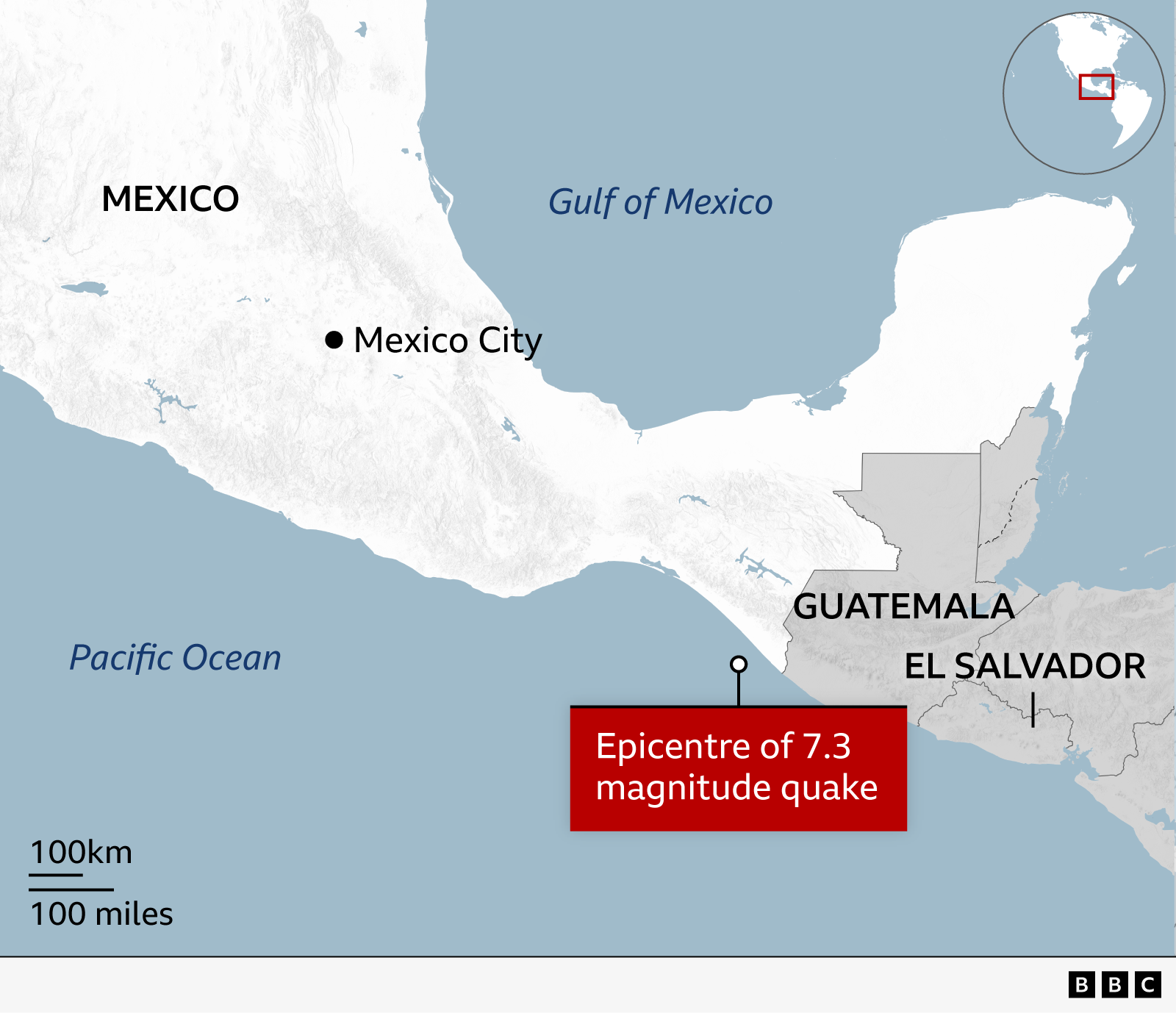
On 17 July a 7.3‑magnitude earthquake rattled the coast to the south of Mexico near Puerto Madero. The US tsunami warning centre issued a hazardous alert for Mexican and Guatemalan coasts, later lowering it after measuring waves up to 0.3 metres. Mexican officials confirmed no serious damage and advised beachgoers to stay away. In Guatemala and El Salvador evacuations followed, and a string of aftershocks from 4.7 to 6 was recorded.
On Saturday a 7.3‑magnitude earthquake struck off the coast of southern Mexico near Puerto Madero at 08:49 local time (14:49 GMT). The event triggered a tsunami warning across parts of the Pacific.
The Canadian‑based United States Geological Survey recorded a shallow burst, just 15.2 km beneath the surface, but it produced no casualties or major damage in either Mexico or Guatemala. Mexican authorities, including Navy Secretary Admiral Raymundo Morales, advised residents to avoid beaches while monitoring local reports.
The US Tsunami Warning System issued a warning of "hazardous tsunami waves" that might affect Mexican and Guatemalan shores. The alert was short‑lived, as the coast line recorded small waves of approximately 0.3 metres above tide level in Puerto Madero and in Chiapas. Officials now urge citizens to observe standard water‑near‑shore caution.
Governor Salomón Jara Cruz of Oaxaca reported that the quake was felt with moderate intensity and urged residents to stay alert. Meanwhile, Chiapas governor Eduardo Ramírez suspended administrative work and asked the private sector to do the same in order to prepare for possible aftermath.
In Guatemala and El Salvador tremors shook buildings, prompting evacuations and sudden relocations. President Bernardo Arévalo confirmed that no fatalities had occurred from a 5.6 magnitude quake centered in Quetzaltenango, and called for calm and compliance with official guidance.
A sequence of aftershocks ranging from magnitude 4.7 to 6 has been recorded. The National Oceanic and Atmospheric Administration (NOAA) extended its warning to coastal nations across the basin, estimating waves less than 0.3 metres over El Salvador, Colombia, Costa Rica, Ecuador, Nicaragua, Panama, Peru and Honduras. These waves persisted for up to 12 minutes in Puerto Madero and 28 minutes in Chiapas.
NOAA advises residents in at‑risk areas to stay alert for updates, heed instructions from local authorities, and remain observant near the sea to keep safe from potential threats.