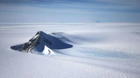
A new map has unmasked the landscape beneath Antarctica's ice in unprecedented detail, something scientists say could greatly enhance our understanding of the frozen white continent.
Researchers used satellite data and the physics of how Antarctica's glaciers move to work out what the continent might look like beneath the ice.
They found evidence of thousands of previously undiscovered hills and ridges, and say their maps of some of Antarctica's hidden mountain ranges are clearer than ever before.
While the maps are subject to uncertainties, the researchers believe the new details could shed light on how Antarctica will respond to climate change - and what that means for sea-level rise.
Lead author Dr. Helen Ockenden from the University of Grenoble-Alpes expressed excitement about this detailed mapping, which could be likened to switching from a grainy pixel film camera to a high-resolution digital image: It's amazing to see the whole bed of Antarctica at once, she remarked.
The methodology combined satellite data with physical modeling of ice movement, allowing researchers to fill in the gaps often left by traditional radar mapping techniques.
One prominent discovery includes a deep channel in the Maud Subglacial Basin, which measures about 50m deep and 6km wide, extending nearly 400km.
This work enhances the understanding of how Ice sheets might respond to climate conditions, vital for forecasting future sea-level changes.
While more investigation is necessary, this comprehensive mapping represents a significant leap toward grasping the topography beneath the ice, paving the way for future climate-related studies.